
OBJECTIVES AND WORKPLAN
Quantifying the temporal and spatial slip variability in the earthquake cycle spanning months to million years timescales
Understanding how successive earthquakes accrue on faults to produce tectonic landforms is still poorly understood. The way deformation is accommodated throughout the crust, in response to the far-field plate tectonics force imposes at plate boundaries, strongly affects the seismic cycle and may control earthquake triggering and the spatial pattern of fault ruptures. The Apennines range, host of the 2016 seismic sequence (5 shocks Mw5-6.5 over 9 months), is a unique area where the accumulation and release of slip over multiple seismic cycles, over time scales of 1yr-1 Myr and spatial scales of 1m-100km, can be determined. We will combine frontier methodologies in geochronology, remote sensing, geodesy, geophysics, high-resolution topographical data acquisition, seismic hazard modelling, all developed and/or mastered by our teams, to quantitatively constrain how portions of the seismic cycle scale up over multiple cycles to produce the cumulative escarpments we see in the landscape.
Several recent studies have revealed episodic earthquake behaviour with alternating phases of intense seismic activity over relatively short time periods, followed by long periods of seismic quiescence. Time variability of slip accumulation has also been shown to correlate with spatial variability, as multiple faults within a system have been found to break in coeval large earthquakes over a few hundred years. Knowledge of the spatial extent of a co-seismic rupture is fundamental for deriving expected earthquake magnitude, an essential parameter for seismic design and population preparedness. Several studies have proposed systematic aspects such as structural or geometric complexities that might stop the rupture. Very few studies, however, unravel whether those barriers are persistent through multiple seismic cycles. Several approaches and models have studied the physics underlying this seismic behaviour, suggesting that there might be longer and larger spatial and time-scale control for those interactions. However, those models mostly rely on observations of the post-seismic or interseismic periods over several years and highlight the crucial need to integrate this short-term behaviour into a longer-term perspective. The conceptual breakthrough that we propose is to constrain quantitatively how the tectonic loading is released by normal fault systems over multiple cycles to ultimately produce the large (100+ m high) cumulative escarpments we see in the landscape. In particular we will address the following unresolved questions:
- Does the segmentation, as seen in co-seismic ruptures, mimic the long-term segmentation seen in the morphology and geology ?
- Do inherited structures control this segmentation ?
- What is the feedback between a single fault loading-rate, and hence its slip recurrence interval, and far-field tectonic forces ?
- What is the percentage of deformation at the surface accommodated by seismic vs. aseismic creep either on or off the main fault (i.e. on secondary faults, or volumetric deformation) ?
- How is the regional interseismic strain accommodated at depth within the crust, and how is it seismically or aseismically released on complex and segmented fault systems ?
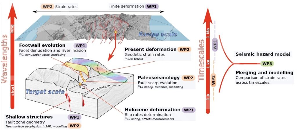
The innovative nature of our project resides in its multi-disciplinary approach to unravel deformation at three time scales,
- The co- and post-seismic (days),
- The seismic cycle time scale (yrs to kyr),
- The long term relief build-up (Myr), and at two spatial scales, that of a plate-boundary in between two moving plates (100 km) and that of fault systems releasing deformation accumulated by plate tectonics (1 km).
Those various time and spatial scales have been rarely studied in a single project so far. Integrating long-term budget of strain accumulation into the study of the seismic cycle has been very difficult and constitutes one of the most fundamental challenges in current seismotectonic research.
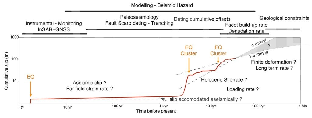
The project is divided into 3 scientific working packages, the first two are dedicated to constrain the slip variability and associated shallow structure at long term (WP1) and short term (WP2), while WP3 is dedicated to modelling.
WP1 : Fault displacement and shallow structure geometry
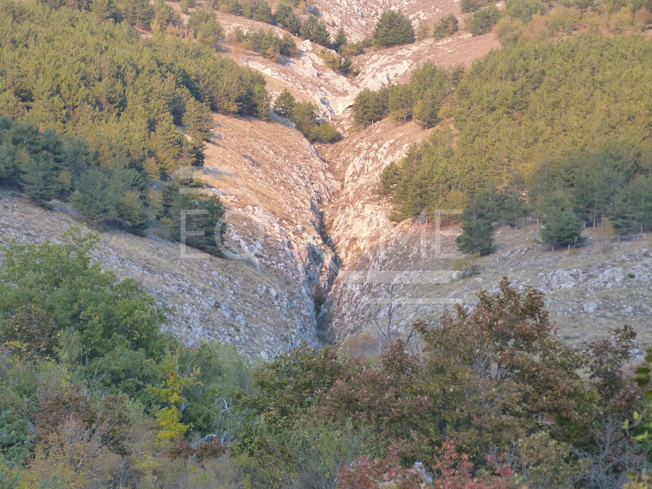
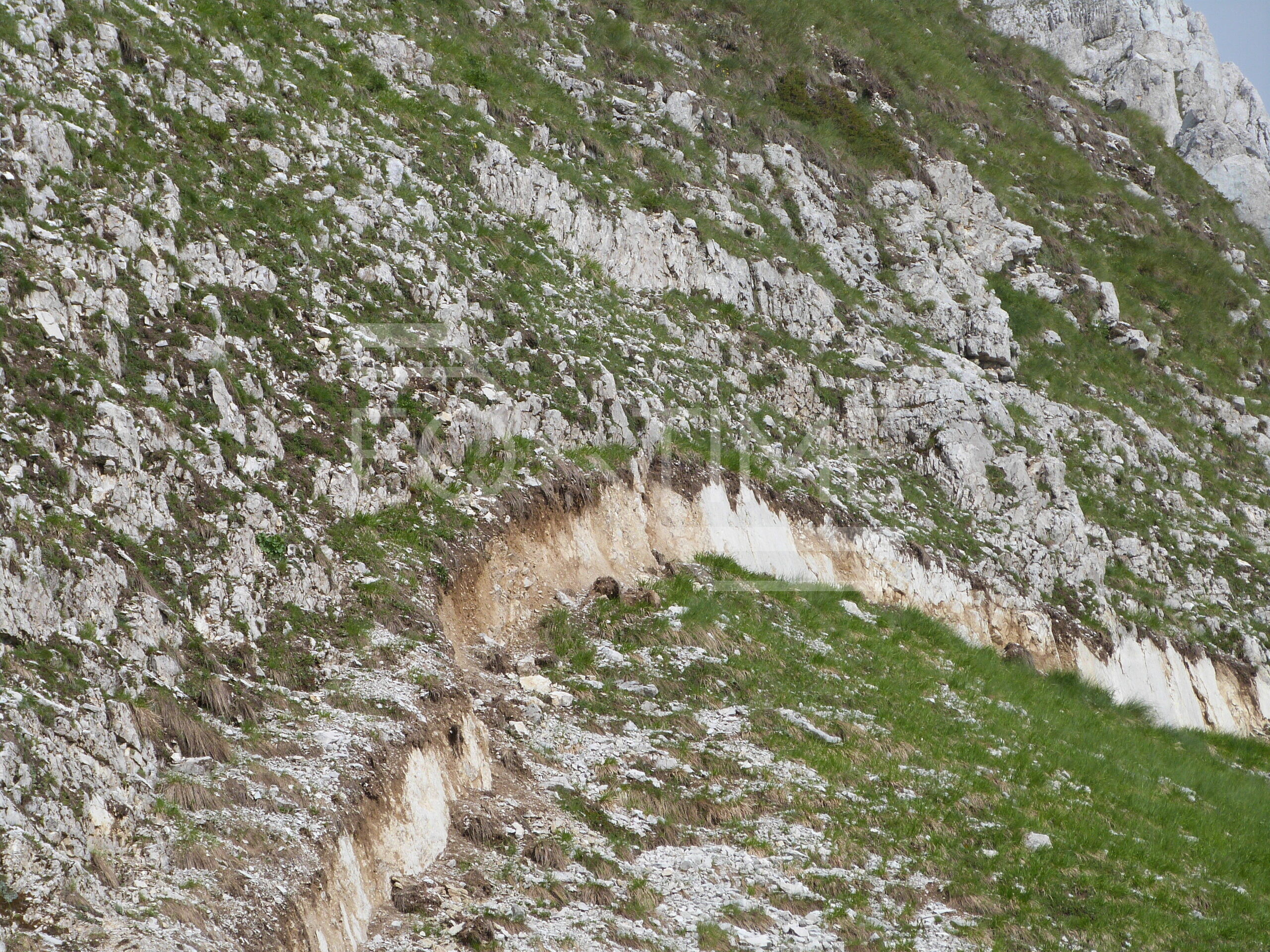
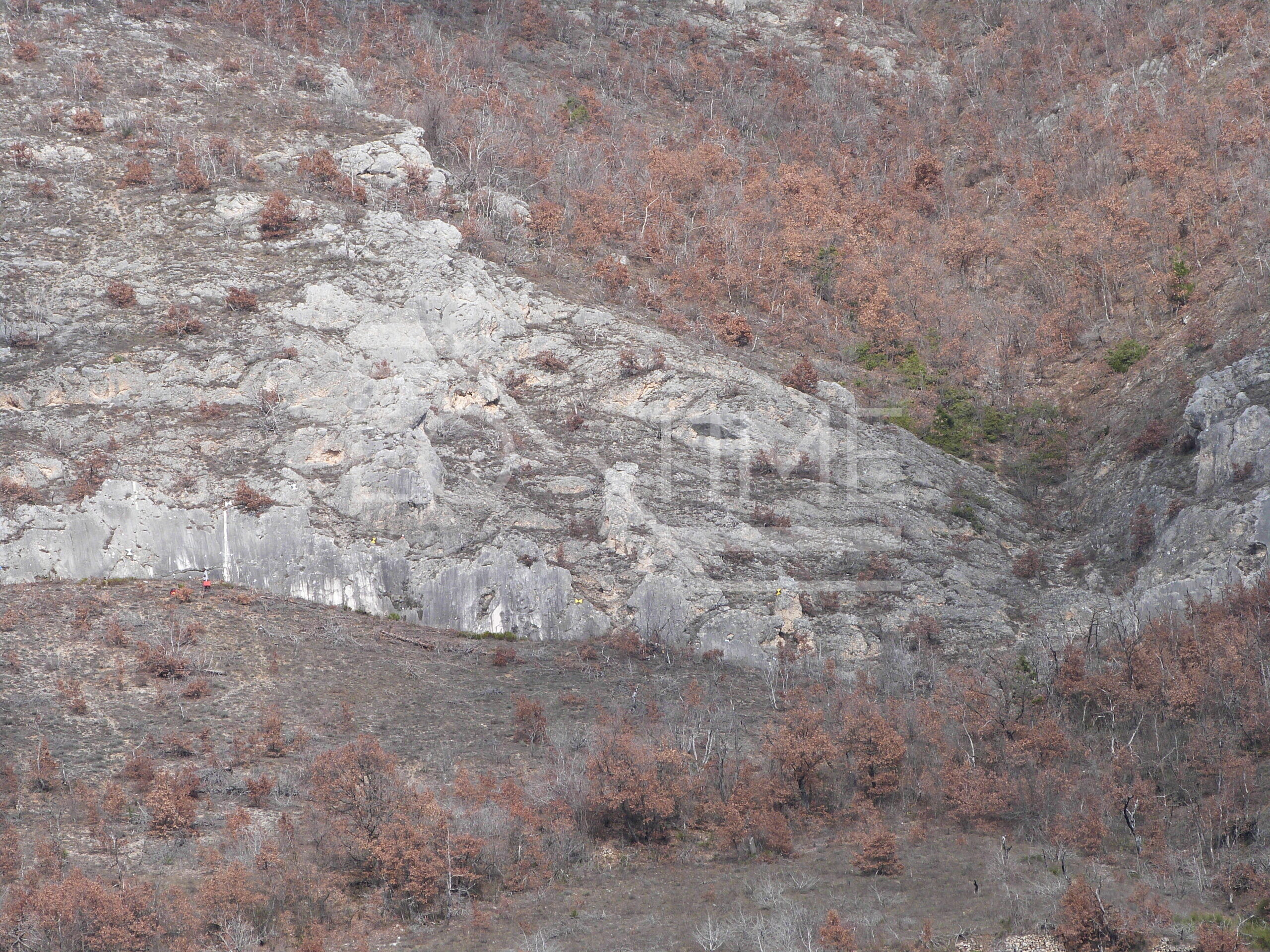
Objectives/Challenges: This workpackage focuses on timescales longer than the seismic cycle (10 ka – 1 Ma) to derive a background picture of the geometry and the evolution of the fault systems, both in terms of slip on individual structures and regional strain accumulation. Additionally, we will investigate how this discrete fault activity is imprinted into the landscape and drive the creation of finite relief. A key challenge will be to integrate both the spatial (from a single fault to a regional transect) and temporal (from Holocene slip rate to geological and landscape evolution over several Ma) diversity of scales into a single coherent framework, allowing a robust discussion with the results obtained in work-package 2.
WP2 : Seismic cycle and slip distribution
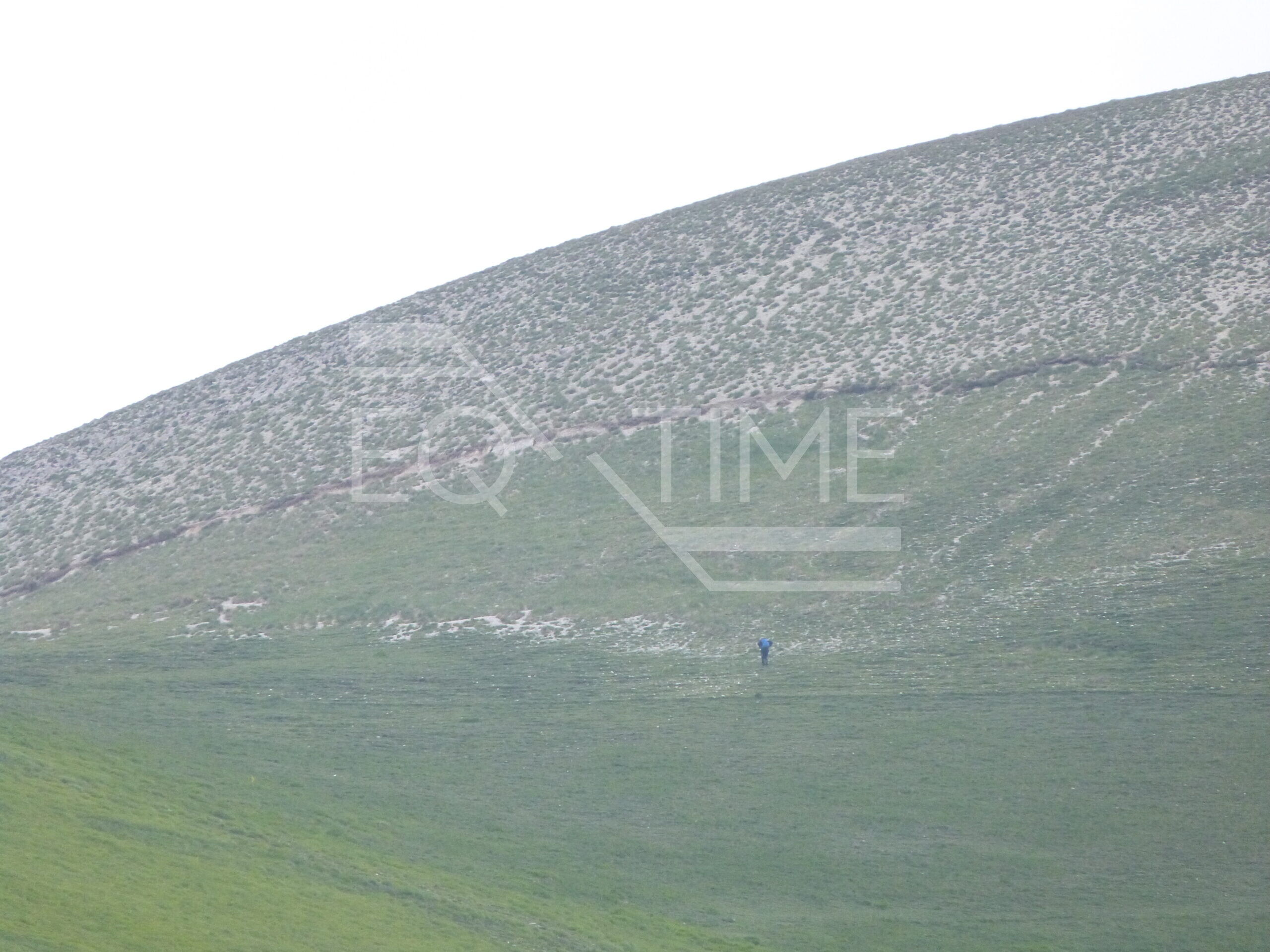
Objectives/Challenges: This work package focuses on short term deformations: from 10-20 Ky to present. The first objective is to constrain the seismic slip history on the main active faults of the three study areas with paleoseismology (Task 2-1), image correlation technique (Task 2-3) and InSAR (Task 2-2), . A second objective (Task 2-2) is to measure by space geodesy (GNSS and InSAR) present-day strain accumulation and interseismic slip-rate. Strain map will show areas of higher or lower strain accumulation that can be confronted with longer term features (historical record, paleoseismicity, geomorphology) to test the hypothesis of persistence through time of strain spatial patterns.
WP3 : Modelling faults in seismic hazard assessment
Objectives/Challenges: Probabilistic Seismic Hazard Assessment (PSHA) estimates the probability of exceeding a specified shaking intensity by combining empirical Earthquake Rupture Forecast (ERF) with empirical Ground-Motion Prediction Equations (GMPEs). The majority of the community is still to this day neglecting, the possibility of earthquakes rupturing many faults in a single event, a key parameter that controls the maximum magnitude in a fault system. There is also a need to develop time-dependent models that account for the stress interactions known to occur between faults.
Expected results
- Constraints on slip rates and locking depth on major Apennines faults.
- Detection and characterization of potential tectonic transients period through the seismic cycle.
- Mechanical functioning of the fault system during the seismic cycle, and partitioning between interseismic loading at depth and versus co-seismic strain release on shallow fault segments.
- Constraints on landscape evolution and relief build-up in relation with temporally and spatially evolving tectonic boundary conditions.
- Lateral segmentation of the fault systems, including spatial mapping of persistent barriers and seismic asperities.
- Improved understanding and modelling of the seismic hazard in Italy, with methods applicable on others faults in the Mediterranean or worldwide associated with low deformation rates but triggering destructive earthquakes.
EQTIME will thus pioneer approaches and methods adapted to deforming areas with low displacement rates and complex geometries that will be applicable worldwide.